Down's Survey of Ireland
A general outline
The Irish rebellion
The outbreak of the Irish rebellion, October 1641, was as an attempted coup d'état by the Irish Catholic gentry,
in an effort to gain control of Irish administration, forcing the British government to grant concessions to the
Catholic majority living under British rule. However, the coup failed the following year resulting in ethnic conflict
between native Irish Catholics British Protestant settlers; a conflict known as the Irish Confederate Wars. The
Confederation became a de facto government of most of Ireland, loosely aligned with the Royalist viewpoint. The subsequent
war continued in Ireland until the 1650s, when Oliver Cromwell decisively defeated the Irish Catholics and Royalists; thus
the re-conquering of Ireland.
As a consequence of the failed rebellion, the Down Survey of Ireland, was undertaken between 1656 and 1658; the first
detailed survey of its type anywhere in the world; the objective of which was to fully document all forfeited Irish Catholic
property for redistribution to British Merchant and Loyal soldiers.
Trinity College, Dublin, have brought together for the first time in over 300 years all the surviving maps, digitising them,
to have them available online via their website, from which the
following are extracts.
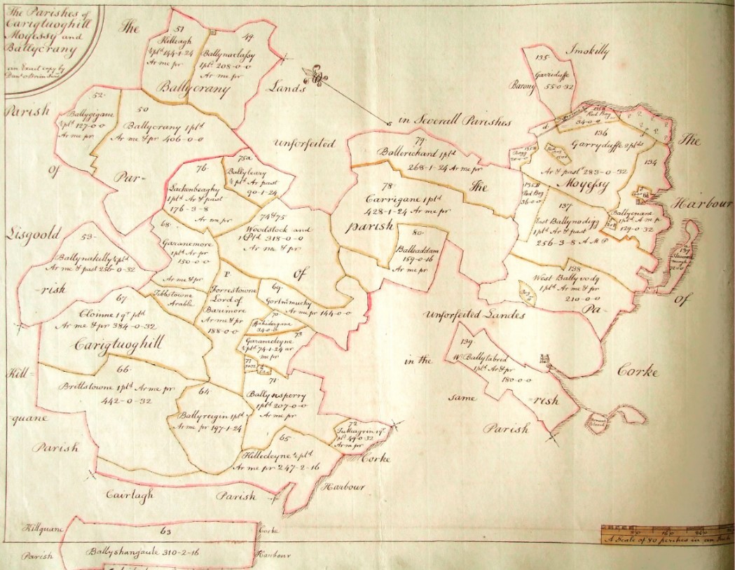
Downs Survey Map of Cork
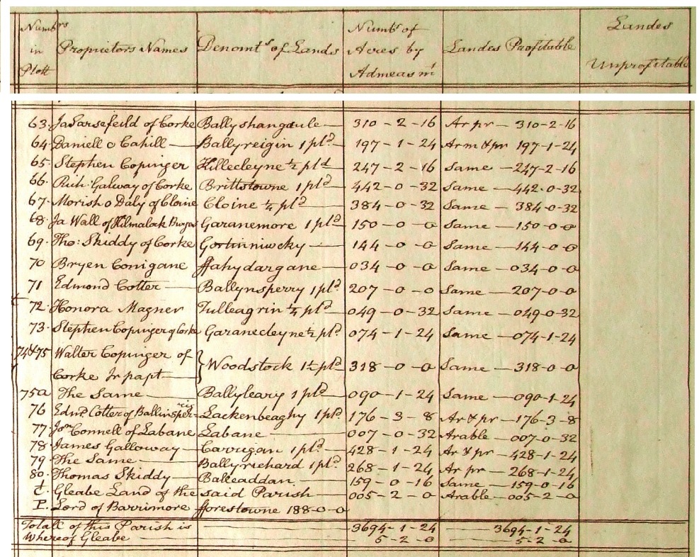
It is interesting to note spelling as "Carituoghill", with all parish townlands falling within the coloured borders which
consisting of a little over 3694 acres.
The last entry of the Parish Occupants table following shows “P” which denotes the Protestant Parish owned by
Lord Barrimore, naming it as Fforestowne, consisting of 188 acres. Viscount David Barry (1604–1642) had died
by this time. His son, James (1630–1694), was the Earl of Barrymore.
It is difficult to see from this map, but to the top left (northern corner) of Ballinsperry (71) owned by
are two plots; Labane of 7 acres, owned by O’Connell (77); and immediately to its right is the Glebe land
of 5 acres.
By the time of the Griffith’s Valuation of 1852 Forrest-Town was recorded as consisting of 124 acres; Labaun
had 13; and Kilcurfin Glebe had 10.
The Parish of Carigtuoghill
Description of Village
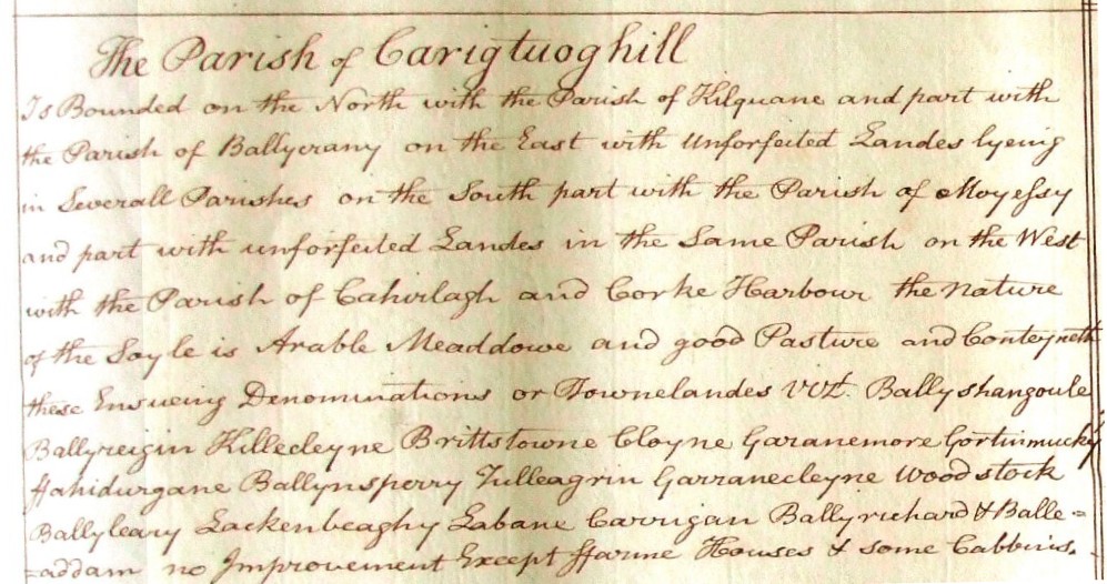
Is bound on the North with the Parish of Kilquane and part with the Parish of Ballyerany on the East with unforfeited
Lands lying in Several Parishes on the South part with the Parish of Moyessy and part with unforfeited Lands in the same
Parish on the West with the Parish of Cahirlagh and Corke Harbour the nature of the soyle is Arable Meaddowe and good
Pasture and Contayneth these Ensueing Denominations or Townlandes VIZ Ballyshangoule, Ballyreigin Killecleyne Brittstowne
Cloyne Garanesmore Gortnimucky Flahidurgane Ballynsperry Tulleagrin Garranecleyne Woodstock Ballyleary Lackenbeaghy
Labane Carrigan Ballyrichard & Balleaddam no improvement Except ffarme Houses & some Cabins."
Parish Occupant
It is not necessary to transcribe the entries for the Civil Parish of Carrigtwohill as they are clearly legible.